









GPS Photo
With Location & Map

Description of GPS Photo: With Location & Map
GPS Photo: With Location & Map is an application designed to enhance photography by integrating location data with images. This app allows users to capture photos while automatically embedding geographic information, making it valuable for anyone looking to document their travels or significant moments with precise context. Available for the Android platform, users can easily download GPS Photo: With Location & Map to start utilizing its features.
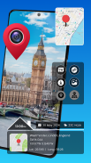
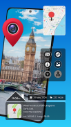
The app facilitates geotagging, which is the process of adding geographic identification metadata to various media. When a user captures an image, the app records the latitude and longitude of the location along with the time and date. This functionality enables users to keep track of where photos were taken, allowing for a more organized photo gallery. This feature is especially useful for travelers and outdoor enthusiasts who wish to remember specific locations associated with their images.
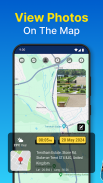
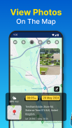
In addition to capturing images, GPS Photo: With Location & Map provides an interactive map view where users can browse their photos based on geographic locations. This allows for a visual exploration of memories, as users can see a map populated with their captured images. The map view enhances the overall experience by providing context to the photographs, making it easier to recall the moments associated with each image.
The app also boasts album organization features, enabling users to sort their photos by date and place. This sorting capability makes it easy to find specific images from a particular trip or event. By categorizing memories in this way, users can quickly relive their experiences without sifting through an unorganized gallery.
Users have the option to import images from their existing photo galleries. When importing, the app automatically retrieves any location data embedded in those images, ensuring that previously captured moments can also be geotagged effectively. If desired, users can manually add or edit location details for images that may not have been captured with GPS data, ensuring a complete collection of memories.
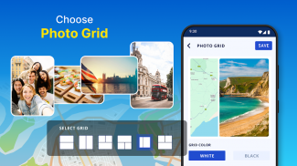
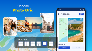
The app includes advanced customization options that allow users to enhance their photos with various layouts and designs. For instance, users can create collages with different grid patterns, combining multiple images into a single frame. The incorporation of travel-themed elements adds a creative touch to the photo presentation, making it suitable for sharing on social media or keeping as personal mementos.
Real-time capture is another notable aspect of GPS Photo: With Location & Map. Users can add timestamps and geotags instantly while taking photos. This feature ensures that every image includes accurate details about when and where it was taken, contributing to a richer storytelling experience. Whether documenting a special occasion or everyday moments, the app captures all necessary information seamlessly.
The GPS Photo: With Location & Map app also supports a variety of layouts for displaying geotagged photos. Users can choose from different styles to showcase their images, including options that highlight the map view and address associated with each shot. This not only enhances the visual appeal of the displayed images but also provides informative context about their locations.
Weather conditions at the time of capture can also be recorded, allowing users to recall not only where they were but also the environmental circumstances during their experience. This additional layer of detail can be particularly meaningful for those who enjoy documenting their travels or outdoor adventures.
The app’s user-friendly interface makes it accessible for individuals of varying skill levels. Whether someone is a photography enthusiast or simply wishes to archive personal memories, the intuitive design allows for easy navigation and functionality. Users can capture, organize, and relive their memories with minimal effort, making it an efficient tool for photo management.
With GPS Photo: With Location & Map, users can effectively document their journeys and create a personalized collection of experiences. The combination of geotagging, album organization, and customization options makes this app a versatile choice for anyone interested in photography and travel.
Those interested in enhancing their photography experience while ensuring all images are enriched with location data will find GPS Photo: With Location & Map to be a practical solution. The features provided by the app align well with the needs of modern users who value both imagery and contextual information in their photo collections.
By integrating location data with photography, users can elevate their photo-taking experiences. This app not only captures images but also tells the story of where those moments occurred, making it an essential tool for memory preservation. Users can explore their captured moments on a map, revisit significant locations, and share their journeys with ease.
For those looking to document their adventures and keep their memories organized, downloading GPS Photo: With Location & Map is a step towards a more enriched photographic experience.


